Preamble
Mount San Jacinto is the highest peak in the San Jacinto Mountains in Riverside, CA. At 10,834 feet, it is the sixth tallest mountain in Southern California (~800 feet lower than San Gorgonio).
Jacinto's fame, however, is because it is a very "prominent" mountain - the sixth most topographically prominent peak in the lower 48 states, at 8319 feet. You could think of prominence as: If the sea level rose such that Mount San Jacinto became an island, its peak would still be 8319 feet above sea level! As such, this mountain looks quite imposing, especially from the east - it towers over Palm Springs and the rest of the Coachella valley.
Top 10 highest and most prominent peak?
Sounds like a great mountain to hike up!
That's what this blog is about.
Friday, Aug 23

Mount San Jacinto also towers of
Idyllwild, the small town I set out from.
 |
The small cell phone picture
does no justice |
Brimming with enthusiasm, I arrived at this 5000 foot elevation town late Friday night after enduring the usual brutal traffic coming from San Diego (even after leaving work early).
An early night was planned - I made reservations at
Knotty Pines and they provided me with small studio cabin - a little place beyond the pines (and a block from town, no less).
 |
| Tasty Lamb Shank |
 |
| Un-named country cover band |
However after a particularly enjoyable lamb shank at
Restaurant Gastrongonme, I was enticed by the sounds of a country band (and beer) across the road at
Jo'An's Bar. A couple pints later I was seriously considering abandoning my hike and instead descending into a good sized bender. But good sense prevailed, and I headed back to my cabin in the woods.
Saturday, Aug 24
I awoke at 7:00am (no Saturday morning coming down, luckily) and drove to
Deer Springs Trail, about a mile outside of town. I debated walking instead of driving. I probably wouldn't be writing this now, had I chose to walk (see the end of this blog for more details).
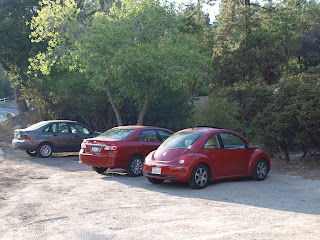
It was a perfect day - 75 degrees, sunny and a slight breeze - at the parking lot near the trail head. After taking some pictures, I was a little confused about how to get to the actual trail, so I went up. This worked.
The first mile was actually tough, and made me a little nervous about what was to come. It was probably a combination of the altitude (I typically hike < 1000 feet), beer, and not being a morning person. The trail climbed at an average rate (maybe 1000 feet over the first 2 miles). It was very dry.
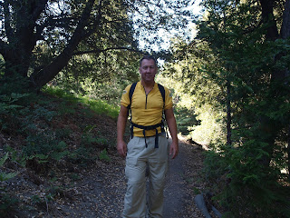
After about an hour, I passed a couple on the trail who graciously took my picture. (They arrived in the parking lot the same time as me, but I took some pictures so had lagged behind them)
Passing someone gave me confidence, and I started perking up just as soon as I came to the first signpost.
Being new to the area, I was worried about being able to find my way. I brought a map, and to be safe, a compass. The former was a nice safety net; the latter wasn't needed. The Deer Springs Trail is well marked, the path is almost always obvious, and the junctions have clear signs.
This is the map/route I ended up following (dots in red). I had hoped to return green dotted path, but Wellmans Divide was closed because of forest fires.
I headed North East (left) towards Strawberry Junction, a section of the trail that was full of lizards. I think this little guy is a
San Diego Alligator Lizard? I named him "Lizzie".
I left him to enjoy the sun on his log, and continued on my way. I could see results of past fires through this area.
I had my first snack - a banana - on some rocks under the pines. The sun was starting to get higher in the sky now, and I was grateful for the shade.
I reached the Strawberry Junction turnoff about 10:00 - making good time - of about a mile per 30 minutes. I naively thought that I would be up and back down in a few hours.
I plodded on my way. Things were getting bigger - rocks, and trees - alike.
However I was feeling great, and didn't stop to take many pictures. About a mile along this section of the path things started to get green.
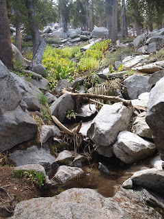
That can only mean one thing - water! Sure enough, amongst a sea of ferns, I found a stream trickling it's way down the mountain. There were a lot of bees here. Luckily I didn't need any water.
Just past the stream was a big rock with some holes in it. I took a picture of it.
I was getting pretty high at this point (elevation, of course). Peeking through the trees I could see I was above most of the other peaks in the area, and could just see the valley floor off in the distance.
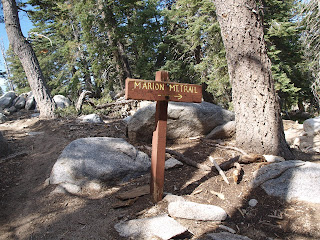
I came across the Marion Mountain trail sign, and then shortly after that the Seven Pines Junction. Only 3.2 miles to the peak; two third's of the way to the top, and a sixth of the way back down!
Shortly after the Seven Pines trail, I saw a large camp down in the gully. I got excited, thinking I had made the 1.5 miles to Little Round Valley camp in a scant 10 minutes, but alas - it was a Ranger Camp (or a well stocked backpacking group)
Things started getting steeper at this point, with a series of switchbacks through a knee/waist high shrub brush with tough, horned branches. I was glad I had my long hiking pants on. I had visions of a
rattler striking me out the bushes. I moved through this section quickly.
I was getting pretty tired now, due in part to the exposure, my tired legs, and the 8500 foot elevation. The open area gave some nice views though.
The trail soon got back under the trees, snaking through large rocks, and up some steep inclines. I was getting very tired now - easily loosing my breath. I was passed by a few groups (surely improving their confidence). Whenever someone was coming up behind me I would stop and (pretend to) have a snack, so I didn't appear too out of shape. On one of those stops, I saw a cloud on the north face trying to make its way up the mountain too! It's not often you're hiking above the clouds, and this gave me a little bit of confidence.
I passed another small stream with a steady flow of water. I still had a decent supply in my bottles, even though it looked clean (but I had no iodine tablets either). I also passed several dry stream beds.
I soon stumbled my way into the last camp before the peak, Little Round Valley. There was nothing little about this valley, nor was it round, but it was flat, so I couldn't complain. It had a half dozen campsites, and an outhouse.
I was now down to the last 1.3 miles to the peak.
At this point it got even steeper (or it did in my mind). It was switchback after switchback, combined with steps up rocks and boulders. I tried setting the camera on a timer to take a picture, but I fell asleep during the 12 second wait.
I put my camera in my backpack for the majority of this final climb, not really having the energy to take it out. I did take one
selfie with my cell phone. Do I look tired?
I finally made it to the last signpost, indicating 1/3 mile to the peak.
There was a semblance of a path for the first couple 100 feet.
Which lead to one of the coolest things on the whole hike!
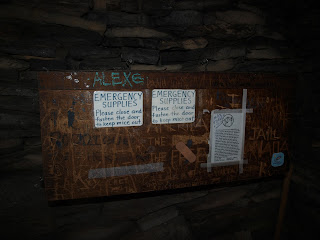
This is the emergency hut, built in 1933.
Its an interesting structure in that it is preserved, and maintained, by the very ones who might need it one day - hikers like myself. Inside where bunks, sleeping bags, a chest with emergency supplies, water and several log books. I logged my signature as proof I made it to (almost) the top in case I was befallen on the way down.
Back to the (non-existent) trail. The last couple hundred feet was a dangerous scramble up large boulders. I read of several people who have fallen and broken bones or twisted ankles here. I was very, very tired - to the point where I had to be careful not to over exert myself for more than a 5 minutes for fear I would pass out. I have fragile ankles, so I took my time.
But I soon saw my goal.
I made the peak!
Clouds were rolling over the southern and western sides of the mountain.
The eastern side, facing down to Palm Springs was completely obscured by clouds
The final picture is looking back towards to Pacific (100 miles to the west)
I headed back down after lunch (crackers, cheese and sausage).
It's interesting how, even backtracking over the same route, things looks very different. For instance, I missed this tough little rock, holding a much bigger rock on his poor little back!
It was the perfect metaphor for how I was feeling.
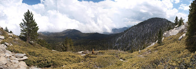
I stopped for a couple panoramas (the latter is looking out towards Suicide Rock I think?).
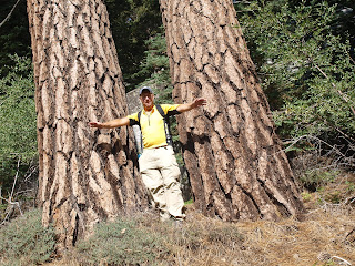
And look at those two trees, and the third massive tree between them!
(Note: I appear to have mental issues in this picture because of the brush I'm standing in. I was paranoid about stepping on a Rattler. I don't like snakes)
It took about 4 hours to get down. I used up the last of my water about 1/4 mile from the end. I was thirsty - I could have used another 12 ounces - but overall I think I planned my water needs well.
My legs were very sore by the end - I probably only had another hour or so left before I couldn't have gone any further.
Seeing hydro lines, and then the parking lot was a relief!
I'm not sure what I would have done if I had walked to the trailhead that morning, and thus had a walk back into town ahead of me. Either hitchhike, or (very convincingly) fake a heart attack, I suppose.
The round trip took a total time of 10 hours, 7 minutes and 32 seconds and .9th of a second to take this picture. An hour of that was spent at the peak, for an approximate times of
I spent the night at the Knotty Pines Cabins again.
My shoulders hurt from carting around a 13 pound backpack all day.
My legs were sore.
Several sensitive parts were shafted.
(I was in no shape to drive 2 hours)
I did enjoy a:
for supper, along with a hamburger.
Sunday, Aug 25
The next morning I woke up at 9:30am, and felt pretty good! The only residual issue was a couple blisters on my feet.
After a tasty breakfast of coffee, eggs, homemade sausage patties, and pancakes at the Red Rooster (it might have been the Red Kettle - it was something Red), I headed home. I stopped at turn-off on Highway #74 and took a panorama of where I just hiked. Notice that the San Jacinto peak is obscured by clouds. I wonder what it would be like up there today?
I stopped in Hemet - a small city in the valley. It was 102f (39c) degrees.
And for 5 bucks bought for a bag of grapefruit, oranges and a massive avocado!
Hemet has good deals on fruit, apparently.
I'm not sure about their real estate, though.
Anyway, this blog could go on forever. I'll stop now while its at least somewhat relevant to the actual hike I did.
Trip Summary
Liquids
Water Consumed: 90 ounces (2.6 liters) = 0 calories
Gatorade Consumed: 32 ounces (1 liter) = 70 calories
Organic Lime Tangerine Energy Shot = 35 calories
Total Calories: 105
Solids
2 Bananas @ ~75 calories each = 150 calories
Cashew & Macadamia Trail mix - 60 grams = 260 calories
Pecan Pie Lara Bar = 130 calories
Mango Sunrise Fruit Strip = 45 calories
Ripened Raspberry Fruit Strip = 45 calories
Chocolate Agave Slo-Burn Energy = 70 calories
Apple Mango Crushed Fruit Power Pouch = 80 calories
Chocolate Espresso Almond Butter = 169 Calories
Cheese, Crackers and Sausage = ~250 calories
Total Calories: 1200
Estimated Energy Expended
Ascending - 5 hours = ~3572 calories
Descending - 4 hours = ~2286 calories
Net Loss: 4658 Calories / 3500 calories in a pound = 1.33 pounds lost.
Note: Plenty of
people disagree with the myth of 3500 calories in a pound. I tend to agree with them.
Update: The full route, with GPX coords, can be found here: http://www.mapmyrun.com/routes/view/685885302


